• Welcome to the Yamaha FZ6 Forums. Member registration disables ads and allows you to post and share. Register Here.

Caladin's 2010 trip: Arctic bound

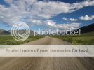
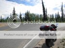
IMG_0230.jpg

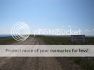
IMG_0233.jpg
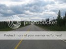
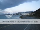
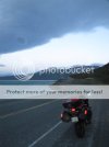
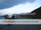
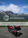
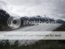
It was just after taking this picture that I decided I had traveled far enough. I was riding along in some deep gravel only doing about 40km/h. The road had freshly been graded. I had my helmet visor open, something i rarely do while moving. All of a sudden a huge bug with several wings flew straight into my eye at full speed. It felt like taking a rock hit to my eye. I couldn't see properly and could barely open my eye. I decided that I had accomplished what I wanted and that now would be the smart time to turn around. So I headed back south. It took a good two hours before my eye felt normal again. I guess I was lucky. That could have been worse.

The forecast had also been calling for rain for the next day. And I knew that if it rained while I was on this road it would bring my speed down to a crawl in most places. Turning around also allowed me more time to ride other roads.
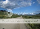
IMG_0234.jpg

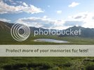
IMG_0235.jpg

IMG_0236.jpg

IMG_0237.jpg

IMG_0238.jpg

IMG_0254.jpg
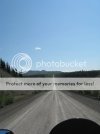
Approaching another emergency runway.
IMG_4337.jpg
 
IMG_0279.jpg

IMG_0280.jpg

IMG_0281.jpg

IMG_4343.jpg

[ame=http://www.youtube.com/watch?v=pDUhWopMbTs]YouTube - Dempster highway on an FZ6 - 02[/ame]
I love seeing that dust trail in my mirrors!

IMG_0282.jpg
Tombstone Mountain.

IMG_0283.jpg

IMG_0285.jpg

IMG_0286.jpg

IMG_0287.jpg
 
IMG_0289.jpg
The last picture of the day. I made it back to the start of the highway.

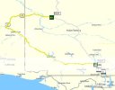
Day 6: 955km / 593mi - Dempster Hwy/Klondike Hwy to Whitehorse YT

Day06.jpg

IMG_0291.jpg

IMG_0292.jpg
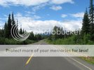
Not bad at all for dirt. I really lucked out on road conditions.

IMG_4345.jpg

IMG_0294.jpg
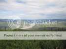
At the overlook for Dawson City.

IMG_0295.jpg
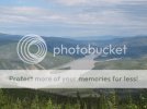
The Yukon River.

IMG_0297.jpg
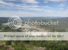
Dawson City below.

IMG_0298.jpg
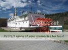
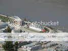
A zoomed in shot of the S.S. Keno below.

IMG_0302.jpg
 
IMG_0305.jpg

IMG_0304.jpg
Dawson City is an interesting place. I walked the main street and checked out most of the stores. I was surprised how done up many of the places were inside. Some places felt more like being in Whistler (BC) then an old town feel. It was all very touristy and not really my speed.

IMG_0306.jpg

IMG_0307.jpg

IMG_0308.jpg

IMG_0309.jpg

From here I headed to the Top of the World Highway. The highway starts just across the river from Dawson City (a free ferry ride) and runs to the Taylor Highway in Alaska.
IMG_0310.jpg

IMG_0311.jpg

IMG_4346.jpg
This highway is closed in the winter (unlike the Dempster that is open year round). Most of the highway on the Canadian side runs along the crests of the hills. It offers great scenery. It is more
unpaved then it is paved. The AK side is totally unpaved and tends to run in the valleys.
IMG_0318.jpg
 
IMG_0349.jpg

IMG_0350.jpg
Welcome to Chicken Alaska. Population 17. Here you can see the Chicken Fire Dept, Chicken Ambulance and Chicken Airport.

IMG_4347.jpg

IMG_0352.jpg

IMG_0353.jpg

IMG_0355.jpg

IMG_0356.jpg
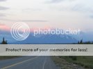
Heading back to Canada via the Alaska Highway. I didn't have time to do any exploring in Alaska this go around. I have to save something for the next trip anyways, right?
IMG_0357.jpg

IMG_4348.jpg
The clouds in the distance did not look so friendly.

IMG_0360.jpg
 
IMG_4350.jpg

IMG_4352.jpg
Yup... look like rains coming.

IMG_0361.jpg
Roads in Alaska were worse then the Yukon. Construction zones were mud pits in places.

IMG_0362.jpg
The rain let loose with full force just after I hit the border. Gravel sections turned to a sloppy mucky mess that was as slick as ice.

IMG_0364.jpg
Canada customs is a good distance inside the Canadian border. Just outside Beaver Creek (pop. 100). The border guard suggested I stay the night in Beaver Creek as the conditions were not good.

I filled up fuel at a local stations and then looked for a place to grab some food. I stopped at one of the 2-3 hotels. It had a dinner attached that closed at 8pm. I made it just in time before closing to grab a quick burger and fries. It was my first meal of the day. The manager did his best to convince me that I should stay in his hotel for the night, he offered a discount. I used their free WiFi to check the weather forecast. It was calling for 3 days of rain for Beaver Creek. I decided I best continue on towards Kluane National Park and hope the weather cleared. Staying the night meant rain likely in the park tomorrow as well. If lucky I would get to see at least some of the park under the midnight sun. As I left the hotel/dinner I noticed a rather large ****roach enjoying the view outside from a windowsill. Hmmmm I think I made the right choice in not staying, why does my stomach not feel good now?
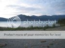
I burned a little rubber after leaving Beaver Creek. I was told the next fuel station closes at 11pm and that I would not make it in time. About 30 minutes later the rain was behind me. I stopped to take a

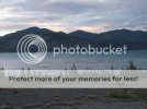
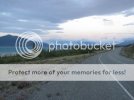
few photos along the way. The GPS is great for letting you know how much time you have to spare.
IMG_0365.jpg

IMG_0366.jpg

IMG_0367.jpg
Rain, blue sky, water, and snow capped mountains. All in one shot

IMG_0368.jpg
 
Last edited:
IMG_0369.jpg

IMG_0370.jpg

IMG_0372.jpg

I made it to the fuel station with 10 minutes to spare. I noticed that down the road from me was a police car running radar. Good thing I had stopped to get fuel rather then continue past.

IMG_0373.jpg
But something just looked odd about this police car. That's when I noticed it was not a police car at all!

IMG_0374.jpg
Its a wooden cut out! complete with reflectors where the lights were. Crafty! That would have me getting on the brakes fast.

IMG_0375.jpg

IMG_0376.jpg

IMG_0378.jpg

IMG_0380.jpg

IMG_0381.jpg
 
IMG_0399.jpg
Lots of snow on the mountain tops still. It was cool. I had my warm gloves on and my jacket liner zipped in. As luck would have it my heated grips switch had the high position kick the bucket. Its the 3rd Symntec

switch I have had die now. Time to find another brand.

IMG_0400.jpg
After midnight now. It got dark enough to see my headlights on the road. But not dark enough to actually see any difference between my high beam and low beam. After about 3 days of daylight it was nice to see it getting dark.

IMG_0401.jpg

IMG_0401.jpg
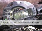
I missed the odometer rolling over 90,000km. I couldn't help but think how cool is this. Hitting 90k km in the Yukon while flying down the Alaska Highway under the midnight sun.

I made it Whitehorse just as the bars were closing down. It was not easy to find a place to stay. At once place I stopped to look for a room I accidentally honked my horn (stebel air horn) while getting ready to leave. Anyone else accidentally hit the horn instead of the starter? There was about 10 very drunk guys standing right in front of the bike, you should have seen them jump. I scared the crap out of them. They didn't take it badly though.


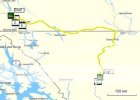
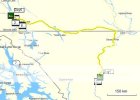
Day 7: 751km / 466mi - Whitehorse YT to Iskut BC

Day07.jpg

IMG_0403.jpg

IMG_0404.jpg
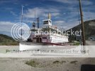
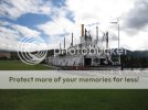
Another paddlewheeler.

IMG_4354.jpg

IMG_4355.jpg

I figured the range of the bike is about 425km with average riding (some hills at 105-110 GPS speed). The distance between 2 fuel stops (if I ignored others on the way) was 425km (264mi). I figured now was a good time to test just how far I could go.

IMG_0406.jpg
I made it to the pump.
 
IMG_0407.jpg
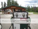
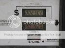
The book states my bike holds 19.2 Liters (5.07gal). And I was able to just squeeze in exactly that!

IMG_0409.jpg
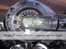
424.9km (264mi) with.....

IMG_0408.jpg
79.9km (49.6mi) on the reserve! Not bad. I've had it run out at 65km (40.3mi) before.

IMG_0410.jpg
Welcome to BC! Onto the Cassiar Highway (Hwy 37).

IMG_0411.jpg

IMG_0412.jpg

IMG_0413.jpg
I had planned to stay in Dease Lake BC for the night. I arrived, low on fuel, at just after 6pm. The only fuel station was already closed! No problem... I will just get a room for the night. Ahhhh not

that simple. Both places to stay had no Vacancy. However they did help me locate a place an hour down the road that had space.

With that set up I stopped for dinner at the only place to eat in town.

IMG_0414.jpg
I walked out of here paying $32 for 2 plates of food and a can of Pepsi. My jaw (or wallet) just about hit the floor. I guess when you are the only game in town you can charge what you like. I ran into several other riders while eating here. It was a large group on different adventure bikes. One commented on how "clean" my motorcycle was. To bad the rain had washed all that Alaska Highway mud off her. Wish I had snapped a picture before hand.

I headed back out on the road towards Iskut. I had to hurry a little to get there before dark. In the middle of nowhere a white SUV rounded the corner towards me. As he approached he flashed his red and

blue lights at me and waved to slow down. To which I nodded and braked quickly. Thanks for the break Mr. RCMP! I was doing about 15-20km/h over.

IMG_0417.jpg

IMG_0419.jpg
 
IMG_0420.jpg

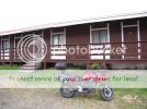
I made it to my humble home for the night. It was very cold that night and near freezing.


Day 8: 749km / 465mi - Iskut BC to Smithers BC

Day07.jpg

So what does $69 get you for a roof over your head in Iskut BC?

IMG_0421.jpg
Yup... that's about right. You really do need to lower your expectations when traveling up north. Most little places have no TV or AC. But once again, despite having no cell signal, I was able to get a

WiFi connection from the hotel. So my blackberry served as my total entertainment system. Playing music, emailing, sending pictures and surfing the web for info on tomorrows travels.

IMG_0422.jpg

IMG_0423.jpg

IMG_0424.jpg

IMG_0426.jpg

IMG_0429.jpg

IMG_4359.jpg

IMG_0430.jpg
 
IMG_0431.jpg

IMG_0432.jpg

IMG_4360.jpg

IMG_0434.jpg
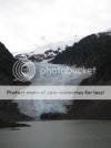
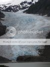
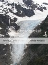
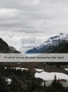
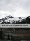
Bear Glacier, about 30km (18.6mi) outside Stewart.

IMG_0437.jpg

IMG_0438.jpg

IMG_0439.jpg

IMG_0442.jpg
Welcome to Hyder Alaska. To reach the Salmon Glacier you must cross into the Alaska panhandle from Stewart BC into Hyder. The road then winds back into BC where you can view the glacier. Its interesting to note that there is no US customs office here. But there is a Canada customs office upon return! Not sure why there is one and not the other. The road is a dead end.

IMG_0443.jpg

IMG_0444.jpg
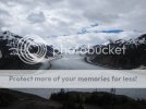
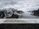
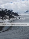
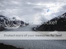
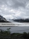
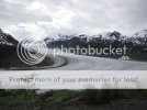
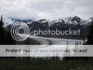
Salmon Glacier.
 
IMG_0452.jpg

IMG_0458.jpg

[ame=http://www.youtube.com/watch?v=6-R6tvV4Eyo]YouTube - Salmon Glacier - July 12, 2010[/ame]

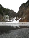
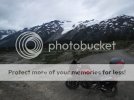
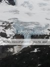
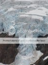
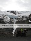
If you continue on down the road you can reach another glacier. Its not as big as the Salmon Glacier, but its worth the ride still.

IMG_0459.jpg

IMG_0460.jpg

IMG_0461.jpg

IMG_0464.jpg
This was a little rougher to get down to this spot then I planned. I bottomed out the exhaust on a big rock. Ouch. Didn't find any damage luckily.

IMG_0465.jpg

IMG_0466.jpg

IMG_0467.jpg
 
IMG_0468.jpg
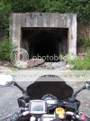
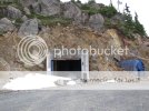
An old tunnel. This area was used for mining. The road now runs around the mountain.

IMG_0469.jpg

IMG_0471.jpg

IMG_0472.jpg

IMG_0475.jpg

[ame=http://www.youtube.com/watch?v=6mEyfdr1X1s]YouTube - ‪Glacier near Stewart BC - July 12, 2010.‬‎[/ame]

IMG_0476.jpg

IMG_0478.jpg

IMG_0480.jpg

IMG_0481.jpg
 
Back
Top