2014 - The Adventures of Final Impact - PNW rides/pics

FinalImpact

2 Da Street, Knobs R Gone
Site Supporter
Joined
Mar 16, 2011
Messages
11,137
Reaction score
184
Points
63
Location
USA, OR
Visit site
No time like the present to plan a few rides right?! 2014 will be my 4th riding season and I'll try to capture some of the locations traveled too and post them here. Its just easier then starting a new thread for every ride plus you get a feel for the climate and conditions as you scroll along and see the scenery change.


MUST RIDE:
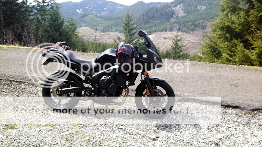
Last year I never made it up into Carson WA to ride Wind River Rd which is an absolute blast so I'm adding that to my list of "must go" places in 2014. Another route is over the east end of Mt St Helen's which is a very technical route due to the volcanic shifting breaking the road. Its more of dirt bike course as you end up tossing the bike quickly so as to reduce the beating man and machine take. My previous partner didn't care for it (liter bike not flickable??), so perhaps I can find someone who will enjoy it. Unfortunately these locations will have to wait until the passes clear of snow and the temperature comes up.

44184d1344796046-look-where-my-fz6-went-today-2012-08-10-ride4uhm.jpg


Lets add the Oregon Coast to the list too! The Wet Dog Cafe in Astoria has some of the best fish n chips! Again, warmer weather and snow melt play a role...

Volunteers for a Lost Lake Run???

Unfortunately gotta wait till March just to get the bike out! :( I'll be back!

2013 Adventures.... http://www.600riders.com/forum/usa-pacific/49202-fizzer-turned-adventure-bike.html
 
Last edited:

mxgolf

Motoup
Elite Member
Joined
Jul 22, 2008
Messages
1,677
Reaction score
16
Points
38
Location
Beaverton Oregon USA
Visit site
Hi Randy, I will be in for some rides this next year for sure. The road to St. Helens and the Johnson Ridge Observatory would be a fun ride. We need to do the Hagg Lake run too with Jon. Just let me know with a few days notice and I will be good to go. :rockon:
 

FinalImpact

2 Da Street, Knobs R Gone
Site Supporter
Joined
Mar 16, 2011
Messages
11,137
Reaction score
184
Points
63
Location
USA, OR
Visit site
OK - Finally some Adventure worthy pics. Sadly, from a quality stand point, the RazR HD Sucks at taking photos!

IMG_20140420_132845_947WEB_zps65ddfed2.jpg~original


End of the line....
IMG_20140420_134132_961WEB_zps0ad75cea.jpg~original


Even found a little waterfall! :D
IMG_20140420_135722_8141WEB_zps8e5af774.jpg~original


IMG_20140420_132401_821WEB_zps0baf7238.jpg~original


IMG_20140420_133641_050WEB_zpsd28c4465.jpg~original
 

FinalImpact

2 Da Street, Knobs R Gone
Site Supporter
Joined
Mar 16, 2011
Messages
11,137
Reaction score
184
Points
63
Location
USA, OR
Visit site
What a great day for a ride 2014-04-20!! I did a fair bit of running around up there. It was a great temperature outside. As I was headed to the Mt I see most of the counties Chip Tar Application is really just marbles everywhere so there was some floating on that. :Flip: It was also brought to my attention that a pissed off Doberman Pinscher can run ~30+mph!

It was great taking off with no real destination in mind and just see where we land. I went to the top of Lolo Pass which turns to gravel in three directions. From the south (the way I came) there was a narrow paved road and I thought I'd follow it. It was eventually blocked by snow. I'm guessing the elevation 5500 ~ 6500 Ft. Wasn't too cold till I had those boot in the snow for a bit.

I tried to post a link of the route but to the observation point on Bluff Rd but gmaps freaks out and tries to undo the actual route taken placing it on the main road. But this almost meets up to Bluff Rd.
========= Paste gmap linke here ==========
https://maps.google.com/maps?saddr=...2G9-A&t=h&mra=dme&mrsp=0&sz=15&via=1,2,3&z=11
====================================

Note: Chip Tar is destroying S20 front tire even running at 34.5PSI
 

FinalImpact

2 Da Street, Knobs R Gone
Site Supporter
Joined
Mar 16, 2011
Messages
11,137
Reaction score
184
Points
63
Location
USA, OR
Visit site
Good chunk of curves in that route.. nice!

You see through me!!! Damn! The best path from A - X does not involve a straight line! :thumbup:

Several of these arteries are great roads too! Trying to get some plans together now that my old buddies "honeymoon newness" is over! We'll post up whatever comes of it.
IMG_20140323_133918_300WEB_zpsb8ad9179.jpg~original

IMG_20140323_121030_656WEB_zpsb431d8bc.jpg~original
 
Last edited:

FinalImpact

2 Da Street, Knobs R Gone
Site Supporter
Joined
Mar 16, 2011
Messages
11,137
Reaction score
184
Points
63
Location
USA, OR
Visit site
A little ride last night after the demo days landed me here.

attachment.php


attachment.php


attachment.php


FWIW: anyone using a RazR HD for photos its looking like the upgrade to KitKat (has Jelly Bean) won't occur for this model so I may be stuck with yellow colors which should be green. :( Never mind what it does to moving water! :shakehead:
This thing has too many short coming sot list when called upon to be a camera so maybe one day I can get a small camera to take with that takes favorable photos. This does not. Although it did OK at the wanna be pano. :rolleyes:
 

Erci

Howie Mandel's evil twin
Moderator
Elite Member
Joined
Apr 28, 2009
Messages
7,229
Reaction score
126
Points
63
Location
Pittsford, VT
Visit site
FWIW: anyone using a RazR HD for photos its looking like the upgrade to KitKat (has Jelly Bean) won't occur for this model so I may be stuck with yellow colors which should be green.

I've got Razr M. Excellent phone on all counts, except for taking pictures. Exceptionally poor camera. I carry a good point-n-shoot for worthy spots.
 

FinalImpact

2 Da Street, Knobs R Gone
Site Supporter
Joined
Mar 16, 2011
Messages
11,137
Reaction score
184
Points
63
Location
USA, OR
Visit site
A little ride last night after the demo days landed me here.

53068d1399580439-2014-adventures-final-impact-pnw-rides-pics-img_20140507_171505_954-jpg


53069d1399580439-2014-adventures-final-impact-pnw-rides-pics-img_20140507_173915_736-jpg


53070d1399580439-2014-adventures-final-impact-pnw-rides-pics-img_20140507_174437_980-jpg

Part of the route to the location above! ^^ Its MUCH fun and very addicting....

After 50 years of being the worst road on the planet and they paved this stretch last fall. They did a pretty fine job of it too! PS - Mid week traffic is nil. :thumbup:
53086d1399667183-i-have-keep-telling-myself-its-not-600-a-exhibita-lol-jpg
 

FinalImpact

2 Da Street, Knobs R Gone
Site Supporter
Joined
Mar 16, 2011
Messages
11,137
Reaction score
184
Points
63
Location
USA, OR
Visit site
From 2014-05-12...

Not an adventure per say but I went looking for Chris's BOTM picture location. Given there are only so many view points or mini mountains in this town, this was my second attempt at finding it....

IMG_20140512_165216_567WEB3_zps5f0b6c9d.jpg~original


First attempt (below) was a bit of a stormy ride. Minutes after this crappy photo was taken, it was down pouring on me.... At least the dried bugs came off easy when home!
lol

View looking South West 2014-05-03):
attachment.php


View looking North - i.e. Mt St Helens is over there somewhere!
attachment.php
 

FinalImpact

2 Da Street, Knobs R Gone
Site Supporter
Joined
Mar 16, 2011
Messages
11,137
Reaction score
184
Points
63
Location
USA, OR
Visit site
Does anyone have a clue what this thing is? It looks like it has potential to be a mini dry dock, but its bound by depth on a tiny man made lake/river with a spill way. Way down stream is a hydo plant but this will never go there. It has me baffled as to its purpose.

Thoughts? PS - No public access for better pictures, so thats as close as you get. It has these giant holes through it on the lower section and I've never seen anything like it. The river is pretty narrow like maybe 0.5 miles wide by 2 miles long. I don't know. Its small enough that its great for water skiing!

[MENTION=14469]motojoe122[/MENTION] Ideas?

More on next post with overhead sky view....
 

FinalImpact

2 Da Street, Knobs R Gone
Site Supporter
Joined
Mar 16, 2011
Messages
11,137
Reaction score
184
Points
63
Location
USA, OR
Visit site
From above - this shows the location.
1st pic, its taking up the length of the boat ramp.
2nd pic, sky view of the river/lake its on. There are log booms across it ahead of the spill way. Kinda fun to walk across the river on a log!
3rd pic, a great road. It carries some speed. Many corners are pretty tame at 80mph.

Last picture, well, its spring run off so water is coming out of everywhere!!
 

FinalImpact

2 Da Street, Knobs R Gone
Site Supporter
Joined
Mar 16, 2011
Messages
11,137
Reaction score
184
Points
63
Location
USA, OR
Visit site
I typically don't joy ride this far after work and start so late but I did a 125 mile run after getting home Wed night. Week has been a week of torture for more reasons than I care to mention so it was good to get out on a long run....

The run up the Clackamas river has the best sweepers ever and with no-one ahead of me, kids will play.... I need a video camera! Stopped here along the way....
IMG_20140521_190404_442WEB_zps13d78c6b.jpg~original


EDIT: links failed.... fixed - >
hidden in this crappy shot, is beauty in motion and tranquility....
IMG_20140521_190757_850WEB_zps904593a0.jpg~original


From last week...
IMG_20140517_170250_335WEB_zps1c166e62.jpg~original
 
Last edited:

FinalImpact

2 Da Street, Knobs R Gone
Site Supporter
Joined
Mar 16, 2011
Messages
11,137
Reaction score
184
Points
63
Location
USA, OR
Visit site
Went on a 140 mile stroll West with Mark... Road atop some peaks and trip around a Lake. Great day for a Ride!!

Looking West from Bald Peak
IMG_20140531_142213_833_zps564d54f6.jpg~original


IMG_20140531_145223_972_zps7e1c0111.jpg~original


IMG_20140531_132154_2941WEB_zps3e846bb1.jpg~original


PS - car's don't do well in pano stich photos! chop chop to the bmrr
 

FinalImpact

2 Da Street, Knobs R Gone
Site Supporter
Joined
Mar 16, 2011
Messages
11,137
Reaction score
184
Points
63
Location
USA, OR
Visit site
Monthly post - love this place. Usually stop and hang here for bit while passing through the valley.
IMG_20140629_171124_174_zps7d184bdd.jpg~original


Here's to cel pic's :Flip:

Edit:
Adding something to offset the string of cel pic's...
DSC_7834_zps5ad5bdbc.jpg
 
Last edited:

FinalImpact

2 Da Street, Knobs R Gone
Site Supporter
Joined
Mar 16, 2011
Messages
11,137
Reaction score
184
Points
63
Location
USA, OR
Visit site
Re: 2014 - 07

Had to bring the new tire up to temp and landed here last night... This is looking southeast:
attachment.php


And to the west from a slightly different vantage point:
Pic is cropped as the bottom was basically black looking into the sun
attachment.php
 

FinalImpact

2 Da Street, Knobs R Gone
Site Supporter
Joined
Mar 16, 2011
Messages
11,137
Reaction score
184
Points
63
Location
USA, OR
Visit site
2014-07-27 - late ride report! [MENTION=3969]mxgolf[/MENTION] [MENTION=23449]motel6[/MENTION]

There was a last minute ride put together to rip up to High Rocks on Mt Hood through some forest service roads.
Scheduled departure was for 930 AM from Carver Hanger.

The three of us were under way and took some nice twisted roads out through Redland and into Estacada. We stopped in Estacada for fuel and then up the Clackamas River (224) and into forest service property where the roads narrow and Chipmunks dash about! The temp forecast was in the low 90's but it never got that hot! Once up at Highrocks we enjoyed the view and relaxed for a bit before heading back down the hill for late lunch at the Cazadero Inn in Estacada! I think we all rounded out the day with 185 miles or more!
After lunch we retraced our route back to Carver and I landed home a little after 4pm. Thankfully the Two Dodge Ram Tuff trucks that tried to kill me failed! One as a near head on collision with him in my lane in a corner and the other backing out from a side road.
It was a good run and one which I enjoy!

And for Nick, the route.... https://maps.google.com/maps?saddr=...;FUcasQIdcgq8-A&t=h&mra=mi&mrsp=13&sz=15&z=15

Now to get the others to post some pictures as I didn't take that many....


Pictures from Highrocks...
attachment.php


South side of Mt Hood:
attachment.php


3 Amigo's:
attachment.php
 
Top